
ONSHORE U.S. – 3 Western Petroleum Provinces – Large regional soil gas surveys are available for sale in the Basin and Range Province, Western Overthrust Belt, and Hugoton Embayment.
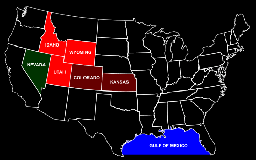
BASIN AND RANGE PROVINCE, NEVADA
AND UTAH
Extensive regional soil gas surveys are available for sale in 21 different
valleys of the Basin and Range Province of Nevada and Utah consisting
of 11,881 sample sites. Typical valleys range from 300-400 square miles
and were gridded with about 400-700 soil gas samples. Total area of all
the 21 valleys is 11,747 square miles or over 7.5 million acres. Three
of the valleys were sampled with additional soil gas sites to provide
denser geochemical coverage. Average soil gas sample density is two sites
per section.
Available Location Maps Online:
Nevada-Utah coverage map
12,212 sites (pdf format 828 KB)
Diamond Valley, Nevada (589 sites)
Fish Creek Valley, Nevada
(533 sites)
Hamlin Valley, Nevada-Utah
(696 sites)
Huntington Valley, Nevada
(904 sites)
Long Valley, Nevada (504 sites)
Newark Valley, Nevada -1- (877 sites)
Newark Valley, Nevada-2-
(771 sites)
Pine Valley, Nevada- 1986
survey (1007 sites)
Pine Valley, Nevada- 1988
survey (965 sites)
Snake Valley, Nevada (1224
sites)
White River Valley, Nevada
(471 sites)
WESTERN OVERTHRUST BELT PROVINCE,
WYOMING, UTAH, AND IDAHO
An extremely large regional reconnaissance soil gas survey has been conducted
over the northern extension of the Western Overthrust Belt of Wyoming,
Utah, and Idaho and is available for sale. This surface geochemical survey
extends over 5900 square miles and contains data from 5728 four-foot soil
gas sites. The survey was also extended over the giant Whitney Canyon-Carter
Creek Field and Ryckman Creek Field for calibration purposes. Average
soil gas sample density is one site per section.
Western Overthrust Belt,
Wyoming-Idaho-Utah Location Map (5,728 sites)
HUGOTON EMBAYMENT, SE COLORADO
AND SW KANSAS
CHASE CARBONATE GAS TREND
A large detailed regional soil gas survey is available for sale in the
prolific Chase Carbonate Gas Trend of the Hugoton Embayment of SW Kansas.
The seven-foot soil gas survey covers an area of about 210 square miles
and consists of 923 soil gas sites. This regional soil gas survey is located
to the west and north of Bradshaw (334 BCFG) and Byerly (47.3 BCFG) Gas
Fields. A number of untested soil gas anomalies exist that are on trend
with established Chase Carbonate gas production
Chase Carbonate Gas Trend
Location Map (923 sites)
MORROW STATELINE TREND
A large detailed regional soil gas survey is available for sale in the
prolific Morrow Sand Stateline Trend (100 MMBO, 500 BCFG) of Colorado
and Kansas. This soil gas survey consists of data from 1832 four-foot
soil gas sites over an area of more than 200 square miles. The geochemical
survey provides continuous microseep coverage over a north-south distance
of 30 miles extending from Arapahoe Field in the north to Moore-Johnson
Field in the south. Soil gas sample density varies from 11 to 16 sites
per section.
Morrow Sand Stateline Trend
Area Location Map (798 sites)
Mojo Jace Area Location Map
(1034 sites)
OFFSHORE U.S. Gulf of Mexico Basin - Large regional marine sniffer survey is available for sale on the shelf area of the northern Gulf of Mexico.
TEXAS AND LOUISIANA SHELF,
NORTHERN GULF OF MEXICO
An extensive marine "sniffer" geochemical database, acquired
by a former major oil company, over the Texas and Louisiana shelf areas
of the Gulf of Mexico is now available for sale. This vast geochemical
database contains over 191,000 dissolved gas analyses. A detailed evaluation
of this database made with respect to discoveries made after the geochemical
data was recorded showed that the data was 88 % effective in finding new
commercial production. This technology not only has the ability to predict
whether a block has hydrocarbon potential, but also whether it is more
likely to produce oil or gas, a very important economic factor in the
evaluation of offshore blocks.
Sniffer
Sampling Locations Map (PDF Format, 3.8 MB)
These regional soil gas geochemical databases in the various petroleum
provinces listed above are available for sale, in whole or in part, for
prices that are drastically below original acquisition costs. Additional
price reductions are given for purchases of large, or whole, data blocks.
Deliverables for the regional geochemical surveys include a soil gas sample
location map, database of x and y coordinates for the soil gas sample
locations, and analyses tables of light hydrocarbon magnitudes (methane
to butanes) by FID analyses and He, and H2, by TCD analyses. For nominal
additional costs, an interpretative report can also be prepared.
Contact information:
e-mail: etimail@eti-geochemistry.com