
INTEGRATED MARINE GEOCHEMICAL EXPLORATION PROGRAMS
DATA EXAMPLE: NORTHERN CHUKCHI SEA, ALASKA
Integrated marine geochemical exploration programs provide an intelligent method of identifying near-surface indications of petroleum seepage with geophysical tools and focusing sampling efforts on the areas with the highest potential to hold migrated hydrocarbons. Typical surveys include mapping gas chimneys on exploration seismic data and confirming near surface acoustic anomalies with high resolution geophysical data. Gas charged zones can then be sampled with gravity/piston cores and borings/jetholes to identify the magnitude, composition and distribution of migrated petroleum.
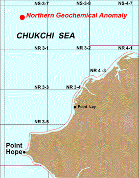
The northern Chukchi Sea geochemical anomaly was initially discovered
from the interpretation of regional high resolution geophysical data.
Headspace gas results from a series of gravity cores were the used to
confirm the presence and distribution of petrogenic gas seepage. After
review of the headspace gas results, eight jet borings were drilled and
sampled to depths of up to 50 feet to provide unaltered sediment samples
for extraction and detailed analysis.
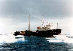
Left: Geochemical Stratigraphic Sampling Vessel M/V Thamrin operating
in the Chukchi Sea, Alaska
Below, left to right:
Location Map
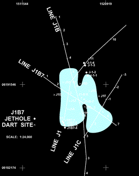
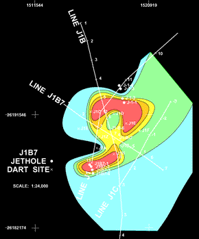
Shallow acoustic anomaly mapped from high resolution geophysical data;
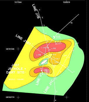
Contoured gravity core methane concentrations;
Contoured gravity core i-butane concentrations.
| Home | Exploration Geochemistry Services | Environmental Geochemistry Services |
©2002 Exploration Technologies, Inc.